
Riverside, CA · metro guide
Landscaping in the Inland Empire: Dry Summers and Defensible Space
With 0.12 inches of rain in July, the irrigation system is the design — and near the foothills the plant list is also a fire decision.
Metro snapshot
Riverside in numbers
Sources named below each block
- Population
- 4.7M
- Households
- 1.5M
- Housing units
- 1.6M
- People / household
- 3.22
- population ÷ households
Owner-occupied homes 66%
The rest are rented. Owners are the ones who commission most exterior work.
Single-family detached 69%
Detached houses carry their own roof, gutters and exterior walls.
Built before 1980 36%
Older housing stock shapes what fails first: gutters, flashing, pipe material.
Season
The year in Riverside
- Precipitation
- 9.4 in
- Snowfall
- —
Average temperature by month, °F — the shape of the year is what decides when exterior work gets done.
Precipitation by month, inches.
| Month | Average temperature (°F) | Precipitation (in) | Snowfall (in) |
|---|---|---|---|
| January | 55.6°F | 2.29 in | — |
| February | 56.3°F | 2.41 in | — |
| March | 59.5°F | 1.21 in | — |
| April | 62.9°F | 0.59 in | — |
| May | 67.6°F | 0.20 in | — |
| June | 73.0°F | 0.01 in | — |
| July | 78.6°F | 0.12 in | — |
| August | 79.8°F | 0.02 in | — |
| September | 76.6°F | 0.11 in | — |
| October | 68.9°F | 0.33 in | — |
| November | 61.0°F | 0.57 in | — |
| December | 54.8°F | 1.51 in | — |
NOAA 1991–2020 climate normals, station RIVERSIDE MUNI AP, CA US (USW00003171). Station observations, not a metro-wide average — a metro that spans a mountain range can differ by more than this record shows.
Population, households and housing shares: U.S. Census Bureau, American Community Survey 2024 5-year estimates, metropolitan statistical area.
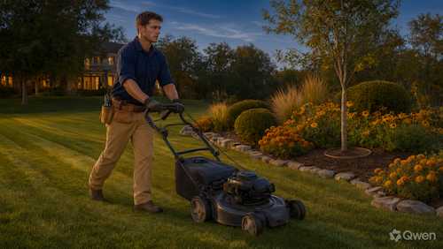
Landscaping here starts from a hard number: the Riverside reference station records 0.12 inches of precipitation in July and 9.4 inches across the year. Nothing survives on rainfall, so the irrigation system is the design, and a plant list that ignores that becomes an expensive way to kill plants in the first summer. Because 69.2% of the stock is single-family detached and much of it is tract housing with a front lawn, the conversion conversation is everywhere — and in the foothill communities it is not only about water but about what the first thirty feet around a house should be made of.
Converting turf without converting to gravel
The cheapest-looking conversion is the one that fails: plastic sheet, a layer of rock and a few succulents, which bakes through summer and gives nothing back to the soil. The durable approach replaces spray heads with drip on separate zones, groups plants by their water use, adds mulch, and treats the trees that are already established as the most valuable thing on the lot. Ask how the irrigation will be changed rather than only how the plants will be arranged, whether the zones can run on different schedules, and what the plan is through the first two summers — because that is when a conversion succeeds or dies.
Caliche, clay and the planting hole
Soils across these valleys range from heavy clay to caliche — a cemented layer that water and roots cannot easily pass. A planting hole dug into caliche becomes a bucket, and a tree planted into it drowns the first time the drip runs long. The details that matter are the width of the amended area, whether the caliche layer is broken through, and whether the site slopes so that water moves away from the house rather than along the foundation. Ask how the soil was assessed, how wide the amendment goes, and what happens to the runoff at the low corner of the lot.
Defensible space in the foothills
For properties near open ground, the plant list is a fire decision as much as a water one. The principles are about the first zone around the building: low-growing, irrigated, well-spaced plants rather than continuous fuel; nothing combustible against the wall or under the eaves; trees limbed up and separated from the structure; and no mulch that carries flame to the house. Ask which zone the property sits in, whether the plant list was chosen with fire behavior in mind, and how the irrigation is zoned so that the defensible area stays green when it counts.
Santa Ana wind and association rules
The wind events do their own damage: they desiccate plants in a day, snap brittle limbs and strip anything loose, and they arrive exactly when the landscape is already dry. Meanwhile much of this housing sits under an association that has views on plant lists, lawns and hardscape. Both constraints are cheaper to satisfy before installation than after. Ask how the planting is protected on the windward side, whether the design has been reviewed by the association, and what the maintenance obligation actually is once it is in.
Trees, shade and the summer bill
A well-placed tree is the cheapest cooling available in this climate, and a badly placed one is a liability: roots lifting paving, limbs over a roof, or a species that needs more water than the site can give. Because the summers are long and dry, the trees that do well are the ones adapted to low water and reflected heat, and they need help for the first two years before they are. Ask which trees are being specified and why, how they will be irrigated while they establish, and where they will be in twenty years relative to the building and the utility lines.
What to pin down in the design
Where this page stops
No prices are quoted and no site is assessed here. Water-use rules, rebate programs, fire-zone requirements and association covenants vary by jurisdiction and change, so the current requirements should be confirmed with the local agency or association.
Riverside metro context
The 2024 ACS 5-year estimates describe about 4.68 million residents in 1,450,250 households and 1,613,300 housing units, with 65.8% owner-occupied and 69.2% single-family detached — the highest detached share in this dataset, and the reason private yards are the main unit of landscaping work here. About 36.2% of units predate 1980. At the Riverside reference station July averages 78.6°F on 0.12 inches of rain, against 2.29 inches in January.
Riverside reference station and housing indicators
| Indicator | Value | Source |
|---|---|---|
| January mean temperature | 55.6°F | NOAA NCEI |
| July mean temperature | 78.6°F | NOAA NCEI |
| Annual precipitation | 9.4 in. | NOAA NCEI |
| Metro population | 4,675,704 | U.S. Census Bureau |
| Owner-occupied share | 65.8% | U.S. Census Bureau |
| Housing units built before 1980 | 36.2% | U.S. Census Bureau |
Station normals are historical averages for one location, not a forecast. The near-absent summer rainfall is the constraint that shapes every planting decision, and the mountain communities above the valleys sit in a wetter, colder regime.
Frequently Asked Questions
Can I remove my lawn entirely?
Usually yes, subject to association rules and any local restrictions, but the conversion has to include an irrigation change. Replacing spray heads with drip and grouping plants by water use is what makes the new landscape survive the first summer.
Why do plants die the first summer after planting?
Often because the irrigation was designed for turf and runs on a turf schedule, or because the hole was amended but the surrounding soil was not. Establishing plants need deeper, less frequent watering than a lawn does.
What is caliche and does it matter?
It is a cemented soil layer that water and roots cannot easily penetrate. A planting hole dug into it holds water like a bucket, so the layer has to be broken through or the planting designed around it.
Do I really need a fire-resistant plant list?
If the property is near open ground or the foothills, the first zone around the house should be low-fuel, irrigated and clear of anything combustible against the wall. It is the cheapest fire protection available.
How do I protect plants from Santa Ana winds?
Windward shelter, plants that tolerate desiccation, and irrigation that keeps up during an event. The wind also dries soil fast, so a schedule that ignores it will lose plants in a week.
Does the association have to approve the design?
Often, for plant lists, hardscape and anything visible from the street. Getting the approval first avoids having to redo work that was already installed.
Sources and review date
- American Community Survey 2024 5-year estimates (CBSA tables) — U.S. Census Bureau, 2024 ACS 5-year estimates.
- 1991–2020 station normals — RIVERSIDE MUNI AP, CA US (USW00003171) — NOAA National Centers for Environmental Information, 1991–2020 climate normals.
Reviewed on 2026-11-18.
Other Home Services in Riverside–San Bernardino–Ontario
All guides for the Riverside–San Bernardino–Ontario metro area